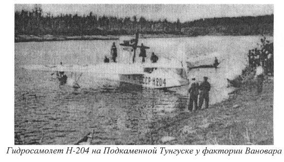
In the figure: The hydroplane N-204 of the Polar Aviation, on the Podkamennaya Tunguska river near Vanavara factory.
The 12 July 1937, a first atempt to begin the aerial survey was made with an hydroplane N-31 of the Polar Aviation. The hydroplane crashed near Vanavara, as it landed in the Podkamennaya Tunguska river (see figure). L. A. Kulik, the photographer S. V. Petrov and the pilot Khudonogov were unhurt, but the survey had to be postponed till the spring of 1938. The 23 May 1938, the newspaper "Aviatsionnaya gazeta" give the information that the survey was planned for June. The aerial photo survey was carried out from June, 27 up to the beginning of August 1938 by Petrov and Kalmykov with the pilot Charnetskiy ("Aviatsionnaya gazeta", 47 (169) 27 Aug 1938). The considerable delay meant that the survey was made when all the vegetation was covered with leaves, thus significantly masking the trees overthrown by the explosion. . In 50 flight hours, 1500 aerial photographs were taken. The survey covered (on a scale of 1:4700) an area of devastated forest roughly equal to 250 km2, i.e. with a mean radius of 12 km from the epicenter (see papers doc, 764 kb, pdf, 1326 kb, pdf, 18.9 Mb).