TUNGUSKA99 Expedition
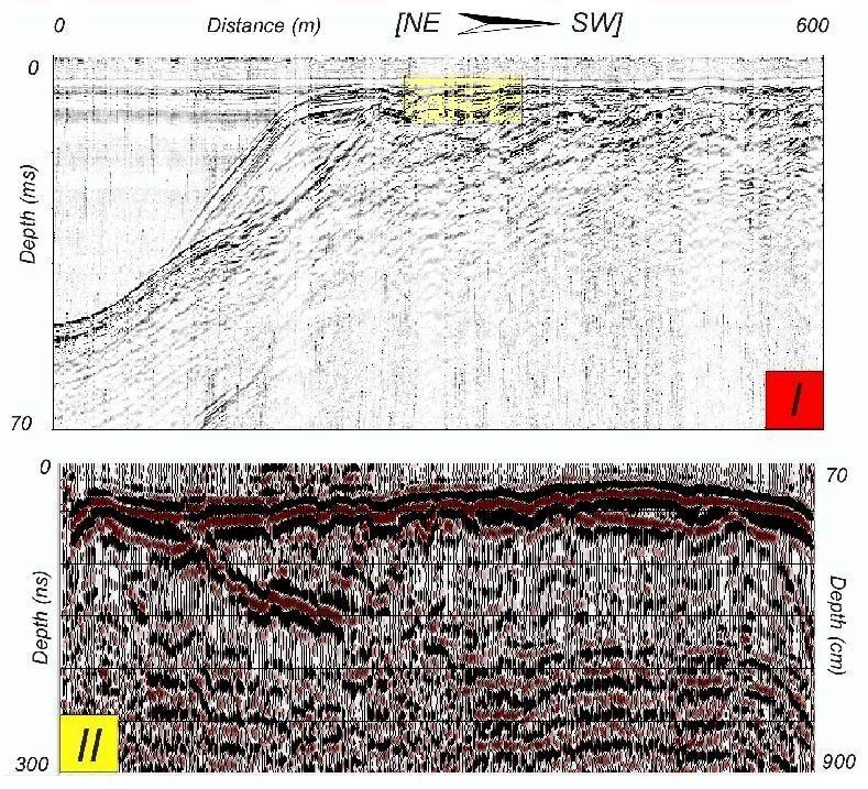
We performed an integrated acoustic and Ground penetrating radar (GPR) study of the lake Cheko. The GPR profiles successfully image discontinuities at depths greater than 7 m. Comparison with acoustic results shows that GPR provides high resolution images of the depth of interest (0-5 m). From the high resolution seismic reflection profiles we can divide the sedimentary sequence in two units: a finely layered upper unit (20-100 cm) and a lower caotic unit, the base of which was not imaged by our profiles. (see papers pdf [1] and [2]). In the figure: Comparison between I) 400 Hz bubble pulser profile and (II) 50 MHz GPR profile. The box in (I) indicates the zone of overlap.