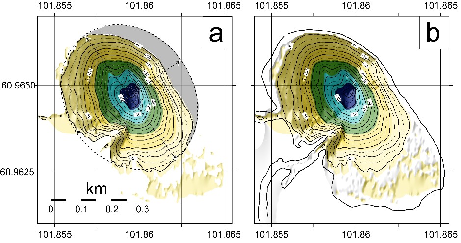
Fig. 3 Morphobathymetric map of lake Cheko: (a) bathymetry below 5 m water depth; and (b) bathymetry including the lakes shorelines. Gray area in a), to the east of the eastern shore, marks the difference between the -5 m contour and a best-fit ellipse centred on the lakes major axis.
The lake appears to be very asymmetric (elongated in a NW-SE direction) if we consider its geometry at water level. However, if we
consider a level of just 5 meters below the surface, the lakes morphology is similar to that of a funnel or of an inverted cone. Most
of the apparent ellipticity is caused by a very shallow (<2 m depth) area that extends onto the southeastern side of the lake. The
nature of the target could also have contributed to the crater asymmetry, because the NE shore of the lake is bounded by a doleritc
hill, where the alluvial deposits of the Kimchu valley pinch out. This could have limited the post impact growth of the Cheko crater
towards the E (Figs 1 and 3).
