Felled trees in 1938 (2).
Felled trees in 1938 (2).
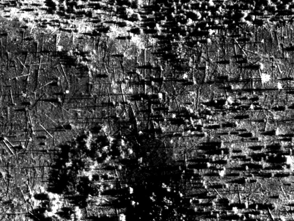
Portion of one of the photos from Kulik's aerial photographic survey. We have measured on the digitalized photographs the direction of single fallen trees and we have obtained an averaged azimuth for each trial area. Moreover we have assigned a reliability degree for the trial area averaged azimuths. The reliability degree has been introduced on the basis of the percentage of singletree azimuths that lay in a sector of 15° centered on the averaged azimuth. The azimuths obtained give information on the direction of the blast wave. (see papers doc, 764 kb, pdf, 1326 kb, pdf, 18.9 Mb).